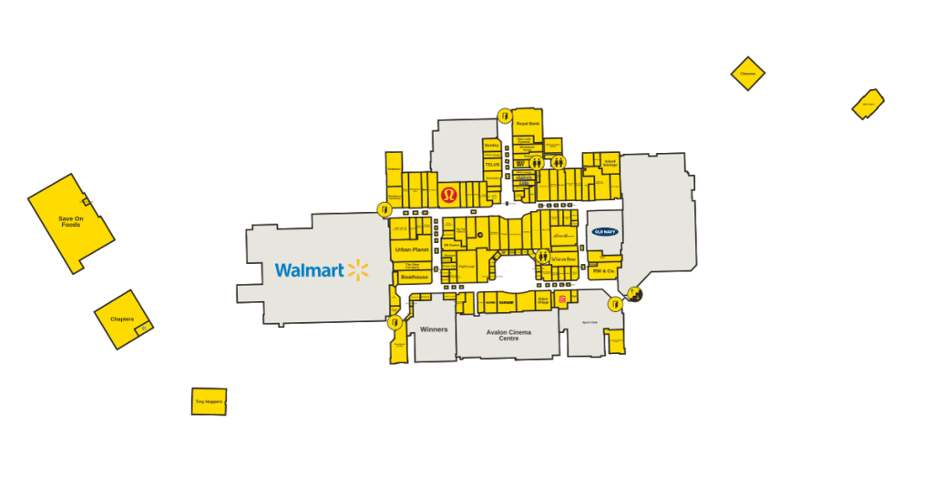
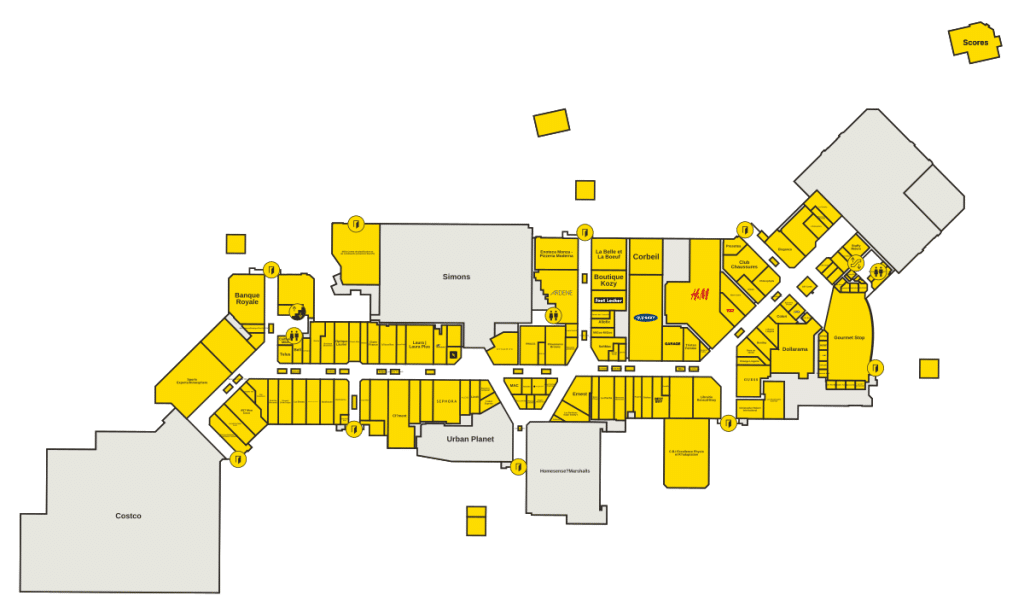
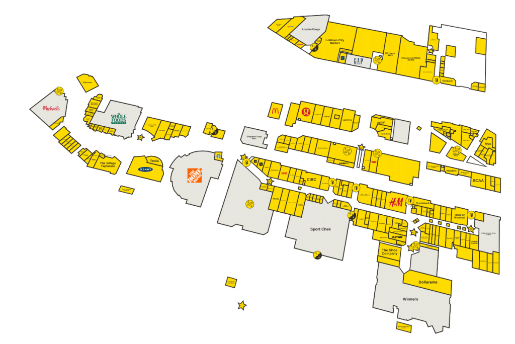
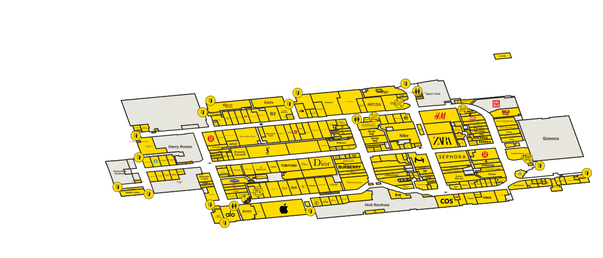
This page shows the interactive map for addresses that our team at MapleVia created for the Yorkdale Shopping Centre, to help visitors find stores and get around without trouble. Using the map below you can see where stores are located and prepare your visit before leaving.
To find a specific store, use the search bar in the upper left corner of the map, which makes it easier. Simply type the name of the store, and it will appear right away. If you prefer, scroll through the categories to browse what options are available.
For a more detailed view of the plan, move the cursor over the map and zoom by scrolling. There are also buttons in the bottom right part to zoom, zoom out, or go to full screen for a clearer view.
How To Use This Yorkdale Shopping Centre Directory Map
Yorkdale Shopping Centre has several floors. They are marked as GL, UL, D3 and LL. By tapping on the labels of levels in the upper right part of the map you can swtich between floors, which helps to know exactly where a store is.
Clicking on any pin of a store, you will receive extra info about that store.
Yorkdale Shopping Centre is a large closed mall in Toronto, Canada. It is made up of two floors full of stores, clothing shops, food courts and retailers. The centre considers itself the best mall in Canada, and it is a truly popular place in the city.
The mall opened its doors many years ago and was the first big suburban mall in Toronto. During its start, the building had the shape of the letter L. At the far ends stood stores like Simpson’s and the grocery store Dominion, while Eaton’s held the corner, where the two galleries met. There was even a tiny internal public library.
A truly new idea for a mall.
It is located northwest of downtown Toronto, right where Highway 401 meets Allen Way. The Yorkdale station on the 1st Yonge. University line of the subway is right beside it, so reaching it by public transit is very easy.
Allen Way itself has history tied to the mall… The expressway originally called Spadina Expressway and later received its name after a city president.
During its opening, the mall offered all kinds of stores that were popular then, jewelers, bakeries, candy shops, photo shops, toy shops and clothing stores. Many of those original brands have long since gone, but the place has changed a lot since that time. Now it has places like Van Cleef & Arpels, Babaton and Apple Store.
There is also a food court space and the Yorkdale Community Arts Centre.
The mall offers accessible parking near the entrance, without need of steps or stairs. There is garage parking, private parking and valet service. Dogs are also aloud.
There is a cinema and an indoor play area for children, which is great for families. Parking costs nothing.
Store hours usually last from morning until evening most days, although on Sunday they are a bit shorter. Even so individual stores and food courts can have different times, so it is good to check before.
That interactive map was correct during its creation, but stores change sometimes, so it will be updated. Bookmark thispage to easily check the addresses before your next trip.